


Live music and entertainment in Bend
May 17, 2024
6 minute read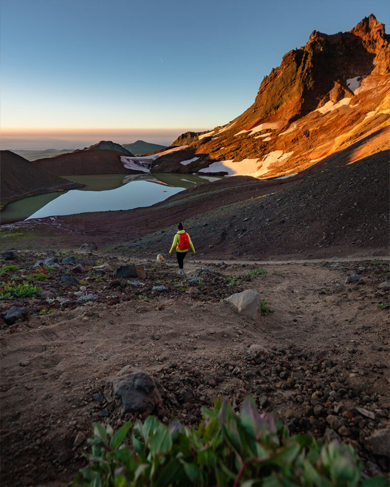
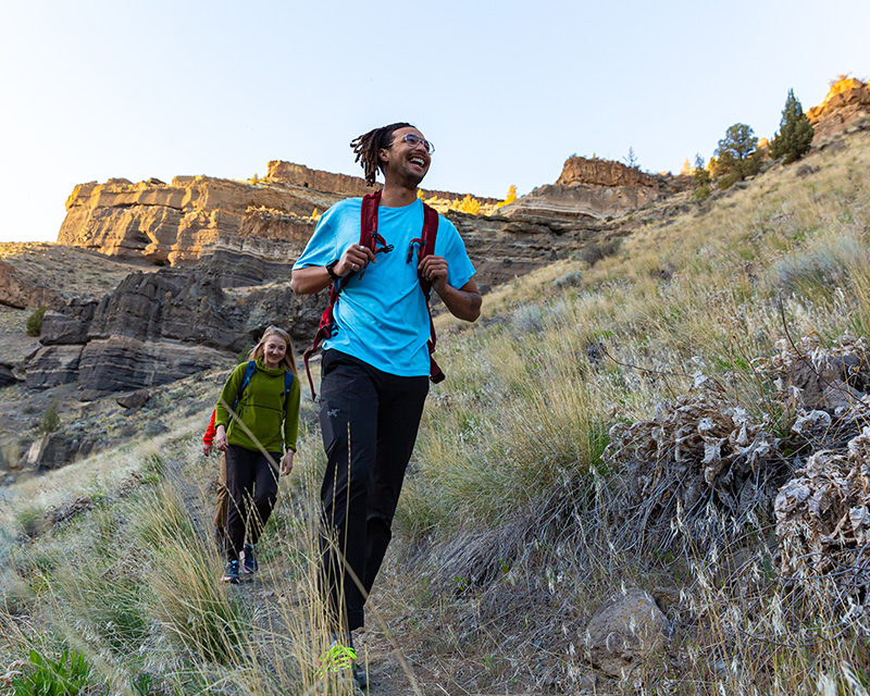
From tree-lined mountain trails to lakeside vistas to volcanic landscapes that look like something from a sci-fi movie, Central Oregon boasts some of the most diverse hiking in the country. There’s truly a trail for everyone, so which will you choose?
Let’s start with the sheer diversity of captivating trails. From mellow paths winding along the Deschutes River to heart-pumping routes taking you high up into the Cascade Mountains, there’s no shortage in variety of distance, difficulty, and jaw-dropping views! Whether you only have a few hours between breakfast and visiting the High Desert Museum, or if you’re up and ready by sunrise for a full day of summiting a mountain, it’s easy to squeeze in a hike or plan your entire day around it.
Within the city limits, you’ll find almost 70 miles of urban hiking trails, thanks to Bend Parks and Recreation. Or explore some of the hundreds of miles of trails in the Deschutes National Forest. Hike along sparkling lakes, through pine forests alive with the melodies of birdsong, or ascend mountains for jaw-dropping panoramic views. Or, head into the high desert, where you can discover out-of-this-world geology that beacons rock climbers from around the world, as well as ancient juniper forests that make for a perfect winter wonderland hike.
The summer season is by far the most popular, with long sunshine-filled days, warm weather, and accessible trails. Springtime rewards us with wildflowers and run-offs that fill our rivers and make an excellent time to discover Bend’s waterfalls. Fall serves up crisp days, fewer pesky mosquitoes, and generally sees fewer recreationalists on the trails. As the snow gracefully blankets the landscape, grab a pair of snowshoes and waterproof boots for an enchanting winter wonderland adventure.
No matter the season, it’s always wise to check trail conditions and access, weather, and fire and smoke forecasts first. As a reminder, please always practice Bend’s Leave No Trace Principles on the trail. These principles help to protect our natural spaces and ensure that everyone can enjoy them for years to come.
Are you ready to feast your eyes on Central Oregon’s breathtaking beauty? Fantastic, let’s talk about some popular hikes around Bend!
Many hikes around Bend require a Central Cascades Wilderness Permit. The wilderness permit system was established to protect these landscapes now and in the future. A Central Cascades Wilderness Permit is required for both day use and overnight stays from June 15th through October 15th. All Central Cascades Wilderness Permits are only available by reservation through Recreation.gov. Check out this article for other need-to-know information, like how to acquire a permit and where you need one.

This “North Star” of Bend’s skyline is a cinder cone created around 190,000 years ago from a now-extinct volcano. Pilot Butte is a short and sweet hike in the heart of Bend. It offers panoramic views of the Cascades towering in procession to the west and big skies and endless high desert to the east. Once you’ve reached the top, take in spectacular views, or check out some informational signs highlighting points of interest and historical facts for an educational moment.
The Upper Deschutes River Trail is a stunning natural area that follows along the Deschutes River just south of Bend. The trail is popular with hikers, as well as trail runners and mountain bikers, and offers stunning views of the river, unique local geology, and towering pine forests. It starts at the Meadow Day Use Area with several access points along the trail, including Lava Island, Big Eddy, Aspen, Dillon Falls, Slough, and Benham Falls. You can hike the entire trail or pick and choose your start and stop points. Dogs are allowed but must be leashed from May 15 to September 15.
Walking around much of Central Oregon, it’s easy to forget that volcanic activity formed the region long ago. But take a short trip under the earth’s surface, and you can experience the area’s geology in a whole new way. Lava River Cave is part of the Newberry National Volcanic Monument. It’s about 15 miles south of Bend and allows visitors to explore a mile-long lava tube. Descend 55 stairs, and then you are off on a self-guided tour of the tube. The cave is open from early May to September 15 and timed entry reservations are required. Tickets are available 30 days in advance. Tickets go on sale at 7 a.m. PST each day.
The Ray Atkeson Trail leads you through one of the most scenic and photographed lakes in Oregon: Sparks Lake. The trail, named after the renowned local nature photographer, gifts us stunning mountain views of South Sister and Broken Top and out-of-this-world geology. You’ll start your hike through a lodgepole pine forest. Watch for the junction where the paved trail veers right as you walk. This is where you’ll find the fissured lava flow and incredible mountain views. Take some time to snap some photos, then continue on your way. The trail will now wind along the lake shore, offering endless opportunities to stop and take in the scenery. Dogs are welcome.
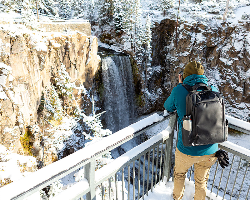
Bend’s most famous waterfall. At 97 feet tall, this splendor along Tumalo Creek fills countless Instagram posts with its majestic beauty. In the summer, the main viewpoint is just a few steps from the parking lot.
Opt to leave the car at Skyliner Sno-Park for a mellower hike through towering pine forests. Enjoy snowshoeing or cross-country skiing to the peaceful frozen Falls. You can reach the Tumalo Falls trailhead by driving less than 30 minutes from Downtown Bend, leaving lots of time in your day for adventures.
Things to know:
Tumalo Mountain supplies spectacular views of the Three Sisters, Broken Top, and Mt. Bachelor. The Tumalo Mountain trail is generally considered challenging by most because of its straight-up climb to the top. But hiking up this shield volcano for the inspiring panoramic views makes it completely worthwhile! Come prepared. Check the weather ahead of time, as conditions at the top of the mountain can be quite different than back at the car. Wind and cooler temps are common at the summit, so a jacket and a warm layer might be a good idea. Dogs are allowed on Tumalo Mountain Trail during summer but the area is closed to dogs from November 1 – May 1.
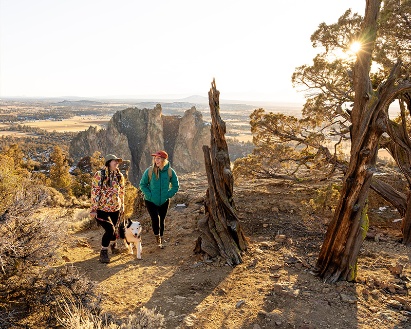
Rest assured, this hike is far from being as daunting as it may sound. On the contrary, Misery Ridge, located at Smith Rock State Park, offers a 100% rewarding experience with breathtaking views! The 3.7-mile loop starts with a leisurely stroll down to the river, setting the pace for what’s to come. You’ll then ascend along steep switchbacks but fear not — there’s a grand prize awaiting you at the summit. Stunning vistas of the majestic Cascade Mountains, the iconic Monkey Face Rock, and the picturesque expanse of Central Oregon’s valley floor. Dogs are allowed, but must be on a leash.
The Green Lakes trail is in the scenic Cascade Mountains, just west of Bend. The trail has been a longtime favorite, and for good reason — the spectacular views! You’ll start the hike by following the trail through lodgepole pine groves to Fall Creek. Then you’ll ascend into a lush mountain hemlock forest with cascading waterfalls. Enjoy wildflowers and obsidian flows before reaching the saddle between South Sister and Broken Top, where Green Lakes await. Dogs are welcome in the Three Sisters Wilderness area, they must be on a leash from July 15 to September 15.
The Tam McArthur Rim trailhead is a beautiful drive from the small town of Sisters, Oregon. It’s a day hike in the Three Sisters Wilderness that gains about 1,500′ of elevation with beautiful views of Three Creek Lake and the surrounding Three Sisters Mountains. On a clear day, you can also catch a glimpse of Mt. Bachelor’s ski area. Dogs can also use this trail but must be kept on a leash from July 15 to September 15. A Central Cascades Wilderness Permit is required for both day use and overnight stays from June 15t through October 15. All Central Cascades Wilderness Permits are only available by reservation through Recreation.gov.
This hike requires research and planning because it’s a tough one. But if you’re up for it, it’s so worth it! South Sister, also known as Charity, is Oregon’s third-tallest mountain and is a very challenging but exhilarating climb. The trail to the summit is steep, long, and rugged, but no technical climbing skills are required. The rewards for reaching the top are stunning panoramic views of the Cascade Mountains, vibrant turquoise glacial lakes, and let’s not forget about bragging rights.
You can take a few routes, but most traverse the “main” or South side route, which starts from Devil’s Lake. The hike begins easily enough through thick pine forests, then emerges onto a sandy plateau. From here, the challenge kicks in. The terrain turns into a mix of sand and rock, then to loose and uneven stones, all while hiking up a steep mountainside. Be sure to take lots of breaks, drink tons of water, and eat plenty of snacks. And always check conditions first and be prepared for changing weather, especially in the early summer.
Accessible hikes in Bend
If you’re seeking barrier-free trails around Bend, you’re in luck! There are several options for individuals who use a wheelchair or have mobility challenges.
Whether you’re an experienced hiker or just getting into it, there are loads of Bend, Oregon, hiking trails to choose from. With stunning scenery in every direction, you’re sure to find an adventure perfect for you.
May 17, 2024
6 minute read
May 17, 2024
7 minute read
May 10, 2024
7 minute read
May 9, 2024
8 minute read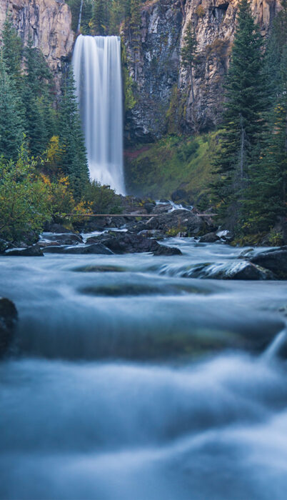
May 9, 2024
7 minute read
May 2, 2024
8 minute read